
Countryfile
Reading the Landscape: The Village Pond
02 05, 14

In the opening decades of the twenty-first century, the village duck pond might seem like a quaint anachronism, a little out of step with modern life, perhaps, despite its obvious charms as a wildlife haven and somewhere to relax awhile. For all its modern serenity, however, the village pond was once a place where the scene would be far from quiet and the pond and its green would be at the very centre of village life. Perhaps hard to believe at this time of year, when the tadpoles begin to climb the slippery pole of survival and natural life flourishes all around them, but for their medieval builders, ponds were huge undertakings and aesthetics were probably the last things on their minds.
Like the village green it is part of, the pond is often common land, a communal facility for the use of the whole village. Historically the village pond is likely to have provided fish – pisciculture was conducted with great enthusiasm in the Middle Ages – and would have been also used for soaking cartwheels (to prevent them from shrinking), washing clothes and as a watering hole for cattle, either grazing on the green itself or providing water for itinerant droves on the move to market or up the valley for summer pasture.
Once those cattle were safely moved up to the downs, another kind of artificial pool, the dew pond, would come into its own. Chalk, limestone and sandstone are porous and, as a result, surface water is absent; dew ponds – sometimes known as mist or cloud ponds – are saucer-shaped circular pools up to eight feet deep at the centre and often constructed in a slight hollow on a hill top. They were made between September and April by touring workers – it would take four men four weeks to make a large dew pond.
Traditionally-made dew ponds are lined by puddled clay, though chalk can also be puddled by reducing it to a powder, adding water until it is the consistency of clotted cream, smoothing it out and letting it dry, whereupon it becomes completely impermeable and better suited to the task than the Portland cement sometimes used by modern contractors.
Once built, the pond is then – confusingly – not filled by dew (or mist) at all, but by rainfall, while the dew pond’s position in a slight hollow helps keep the water cool and reduces loss by evaporation.
Claims are made that the two dew ponds of Chanctonbury Ring on the South Downs in Sussex date back to the Neolithic, but the oldest recorded dew pond is Oxenmere on Milk Hill in Wiltshire, which is named in a Saxon charter of 825 CE/AD.
Comments
Reading the Landscape: Holloways
29 11, 13
Of all the various roads and paths that snake their way through the countryside – A roads, B roads, byways and bridleways – it’s interesting to note that some ways are invested with a little more romance than the rest and by some ways, I mean green lanes and holloways.
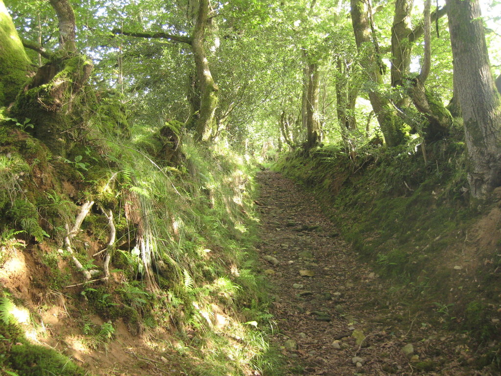
While ‘green lane’ is a catch-all for many different kinds of unsurfaced rural road or path – such as an old drove, a coffin road or a ridgeway – a holloway is a more specific term. It describes a sunken green lane, a track which was been worn down by the passage of thousands of feet, cartwheels and hooves over hundreds of years, even millennia. With the loosened soil subsequently washed away by the next downpour, the course of a holloway will often become more pronounced on the side of a hill because of the extra energy imparted by the surface water run-off.
Holloways are common in lowland Britain with the greensands of the southern counties – Wiltshire, the Weald and the Chilterns – being particularly suited for their formation, as is the old red sandstone of the Wye and Usk valleys of Wales and the Marches, while the new red sandstone of south and east Devon has splendid, deep lanes on its slopes.
Over time, as they are inscribed ever more deeply and the level of the lane lowers, they become more sheltered and trees arch over, creating a womb-like tunnel, an enclosed place of natural safety. So safe, indeed, that it’s only around this time of the year that the walls of foliage have died back enough to get into some old lanes, long-since-abandoned by changing patterns of passage over the land, bypassed in favour of a better route.
Where holloways have fallen into disuse for even longer periods, they can be discovered anew – many centuries after they were last followed – by tell-tale shallow linear grooves through fields or woodland, though check that it’s not a short stretch of long-forgotten park pale or a defensive ditch, both of which will be accompanied by a bank above the natural ground level.
Holloways have their own atmosphere, an unexpected quality which cannot be explained away purely in terms of the local topography or geology. As ancient routes, they are the perfect expressions of collective will, tracks which share a common origin with desire lines – those unpaved paths across city parks or shortcuts over open ground that urban planners never anticipated. As travelling long distances was more difficult in the past, the reasons were more keenly felt; every footstep has meaning on a pilgrimage and the burdens shouldered on a well-used coffin road were more than the purely physical.
Reading the Landscape: Trig Points
25 10, 13
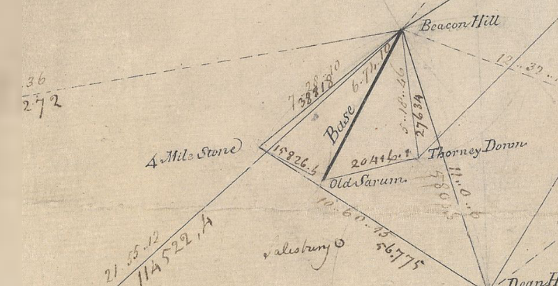
Just northeast of Old Sarum, the abandoned city that looms over younger, yet medieval, Salisbury, lies a monument important enough to be marked on Ordnance Survey maps, along with an intriguing inscription: ‘Gun End of Base’.
In many ways, it’s the most important point on the map, because if it wasn’t for Gun End of Base – actually the muzzle of a cannon buried vertically, business end up – there might not be a map at all. This is the spot where the first definitive mapping survey of Britain began in 1794, where initial measurements for the ‘principal triangulation of Britain’ were taken by Artillery man Captain William Mudge.
You can still see the snout of the cannon at Old Sarum, but the gun at Beacon Hill, 7 miles to the north where Mudge set his theodolite, was eventually replaced by a triangulation pillar, or trig point, 140 years later.
A small, tapered obelisk 4 feet tall and 2 feet square at the base, often found at the summit of a hill, the trig point is a welcome sight for walkers and climbers, although you don’t always need to scramble to the top of a draughty peak to bump into one; starting with Cold Ashby in Northamptonshire – in the middle of a rather flat field at SP644765 – there were around 6,500 built between 1936 and 1960, including one on the Little Ouse in Norfolk TL617897, a metre below sea level. Today, around 5,500 pillars remain at large, though only 110 remain in active service as part of a GPS-style network.
A familiar fixture in the British countryside since the OS built them to survey the country anew, the stability of trig points enabled surveyors to take very accurate measurements which allowed them to perform calculations that, in the trig point’s day, were accurate to 20 metres from one end of Britain to the other. Satellite technology has now improved that to just 3mm.
Trig points aren’t the only mapping artefacts you can discover in the field. Small metal plates marked with a broad arrow pointing up to a horizontal line, or ‘bench mark’, indicate a known height above sea level – and can be found on most pillars as well as the sides of churches, bridges and public buildings. They are joined by around half a million chiselled-out marks on walls all over Britain, which helped to define every last contour and spot height that appear on the map, often next to the triangular symbol that marks the trig point. And, as you catch your breath from the climb up to that pillar, you’ll see that if there’s one thing you can be sure of, it’s a fine view – of the next one.
Reading the Landscape: Deserted Medieval Villages
29 09, 13
The eternal peril of its pubs and post offices aside, it’s hard not to view the British village as something of an indestructible institution, but it wasn’t always such a permanent fixture and the threats that it faces now pale into insignificance next to the menaces of the middle ages, when entire communities could be smeared from the map on the say-so of just one person.
The ‘Medieval Village’ label on Ordnance Survey maps carries an inevitable presumption of plague, but the spectre of a multitude of whole settlements exterminated by the Black Death is an exaggeration. Conspicuously large churches, like the magnificent St Mary’s at Tunstead in Norfolk where construction work was halted by the Great Mortality (as it was known at the time) are perhaps better indicators of the plague’s effect; villages were certainly weakened and reduced, but they were not always completely extinguished.
The real menace of the middle ages – the agent of chaos that threatened communities up and down the land – turns out to be nothing more than the humble sheep. Innocuous and dim as individuals, in farmed flocks their role as woolly bailiffs was well-established before, and for centuries after, the Black Death left its mark.
Cistercian monks were among the first to farm sheep on the enclosed lands of evicted villages. The Cistercian craving for isolation found expression in the destruction of villages like Cayton and Herleshow in Yorkshire in the twelfth century, both given to Fountains Abbey in return for eternal salvation for their noble freeholders, while tenants suffered the temporal damnation of being forced to move on.
The Black Death would play its own merry part later. With a reduced working population demanding better terms, the manorial lords, perhaps inspired by the Cistercians, filled their lands with sheep. Wharram Percy in the Yorkshire Wolds, the most famous of Britain’s 3,000 abandoned villages, was finally cleared in the early sixteenth century and enclosure continued in England for another three hundred years. From the seventeenth century on, enclosure was increasingly for country house emparkment, where designers like Lancelot ‘Capability’ Brown grazed on the profits of landscape enclosure in place of the sheep.
In Scotland, the ovine menace reared its ugly head once more in the infamous Highland Clearances of the eighteenth and nineteenth centuries. Some of the most brutal of the clearances occurred at Boreraig and Suisnish on the north shore of Loch Eishort on Skye; families were forcibly evicted and sent packing, their homes burnt down. Geologist Archibald Geikie who happened to witness the eviction in 1853 described the cortege that led north along the track from Suisnish and the grief-laden wail echoing along the strath as a ‘prolonged note of desolation’.
Reading the Landscape: Saxon Churches
31 08, 13
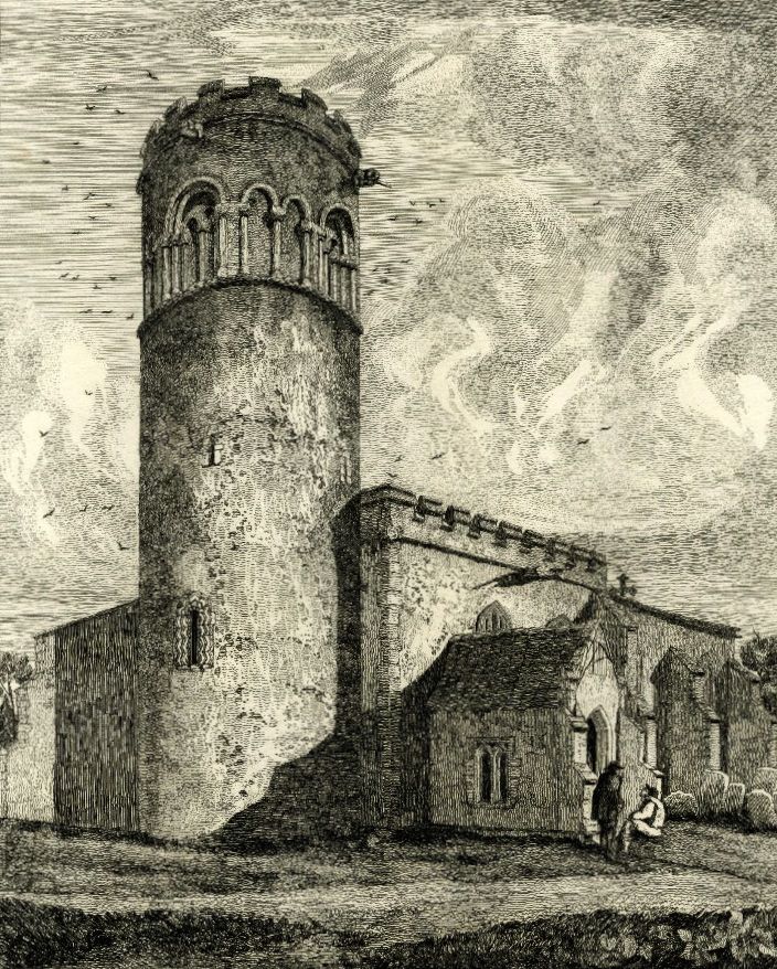
Above: Little Saxham in Suffolk - Most of Britain’s round Saxon church towers are in East Anglia
Church building being what it is – a rather drawn-out process that can occupy an entire generation or two, if not centuries – it’s perhaps no surprise that, nonconformist chapels aside, there are very few churches in Britain built wholly in one discreet architectural style. Given that Anglo-Saxon rule – from the early 5th century to 1066 – ended almost a millennium ago, it seems unreasonable to expect to find very much of their architecture left that hasn’t been substantially ‘improved’ upon or remodelled during the 950 years of fads and fashions that followed. But it is out there, you just have to look for the clues.
The most distinctive architectural indication is the triangular-headed window; where ever you see one, such as those at St Mary’s Deerhurst, four miles down the Severn from Tewkesbury, it’s conclusive evidence of a Saxon church, as is the tower’s herringbone masonry – a feature shown off to staggering effect at St Margaret of Antioch’s in Marton, Lincolnshire. Not all the windows have triangular heads, however, Saxon windows and doors often have rounded arches which can be distinguished from their Norman counterparts by chunkier stonework, particularly the roughly turned supporting pillars or ‘balusters’ which can call to mind over-engineered snooker table legs in their form.
Another strong, though similarly unfussy, detail is the Saxon pilaster, a thin, vertical stone column that bears a resemblance to the timbers found in Tudor vernacular architecture. Together with the string-courses that finish every storey of the tower at Earl’s Barton church in Northamptonshire, the half-timbered Tudor look is striking.
There’s good reason behind the unsubtle – and what many might regard as heavy-set – overtones of the Saxon church; the hammer and chisel didn’t make it into the stonemason’s toolkit until the second half of the 12th century and until that happened, Saxon, as well as early Norman, masons had to craft their stone with a hatchet.
As buildings that have been in continuous use for centuries, all old churches are works in progress and so their architectural features, historically, have always been at the mercy of fashion. There is one Saxon feature, however, that is present in almost every parish church built ever since, the tower. As part of a place of worship the tower is a Saxon invention which has been adopted into British church architecture in a variety of forms. Figuring among the Saxon forms of it are a smattering of rather beautiful round towers – most, like Little Saxham in Suffolk are located in East Anglia. The reason for this concentration of round towers might be geology; the local building stone is flint, which, because of the way it fractures, is very difficult to build corners with.
Reading the Landscape: A Lot of Roman Around
31 07, 13
Known as Quintilis before Julius Caesar modestly renamed it in his own honour, the month of July is a fitting time to consider one of the most striking features of the British historic landscape, the Roman road. Although there are about 2,000 miles of them shown on Ordnance Survey maps, estimates of the total length of the network, including presumed minor thoroughfares undiscovered and skulking under fields, suburbs and industrial estates across Britain could expand it to around 6,000 miles.
They were built as logistical tools of empire, to move legions and supplies at speed and, it seems in some cases, to scare the willies out of the locals; Ackling Dyke on the chalk upland between Martin Down and Blandford Forum strides out across the landscape on an overstated, six feet high embankment that shows utter contempt for the barrows, dykes and cursus it merrily ploughs through. The bank – or agger – of the road, though exaggerated, is of a typical layered construction; indeed, the latin word for layers, strata, gave us the word street, an Anglo-Saxon place name often found along the course of Roman roads. Stretford, Stratford, Stretton, Street and their ilk are common names of settlements found along the way, while the Norse word for road, ‘gate’ – particularly when used with ‘stone’ or its derivatives Stan, Stane or Stoney – might also indicate the course of a Roman road.
In Europe the maxim holds that ‘all roads lead to Rome’ while in Britain, they tend to radiate from London. The Fosse Way – between Exeter and Lincoln – goes against the grain, however, and may have even started as a defensive structure during the early years of the invasion, then adapted later as a road and an enduring one, to boot; much of it survives as a taut thread of primary and secondary routes through a tangle of English country lanes. Despite their reputation for straightness (between Ilchester and Lincoln, a distance of 180 miles, the Fosse Way never deviates more than 6 miles from the crow’s flight) pragmatism forced Roman architects to make more concessions to the landscape over time and the Roman road eventually learnt how to bend.
Stanegate, which crosses the Pennines south of Hadrian’s Wall between Corbridge on the Tyne and the Solway Firth, is one such winding road. It connects at Corbridge with Dere Street, the most easily traceable Roman route into Scotland, running all the way to the Forth Estuary. Given that there’s evidence of Roman activity as far north as a line from Stirling to near Stonehaven and claims of a fort at Inverness, there are likely to be many more roads found, long-forgotten, on the outskirts of towns or hidden in the remote straths and glens of Caledonia.
Reading the Landscape: Name that Tumulus
26 06, 13
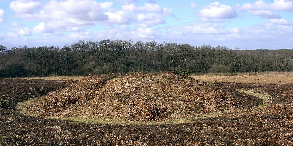
Above: A bowl barrow on the ridge on Matley Heath, near Ashurst in the New Forest, Hampshire. Image: © Jim Champion | CC BY SA 2.0
With up to 20,000 burial mounds in Britain and ‘tumulus’ a common word on Ordnance Survey maps, it’s not surprising that wherever you go, a barrow, howe, hump, or tump is never far away; of all the ripples and bumps on the land, barrows are the most abundant hummock of all.
They might be ubiquitous, but they’re far from uniform, occurring in a wide variety of shapes influenced by geology, the materials that were available and the shifting cultural trends of 4500 years. In some places, these different species of barrows occur as swarms around other features – especially henges (there are around 300 barrows in the immediate vicinity of Stonehenge alone) while others appear to have a relationship to parish borders – vestiges of Saxon estate boundaries which may, in turn, follow older territorial lines.
The most basic – and common – form of tumulus is the upturned dish shape of the bowl barrow (above), a burial mound that has adopted a consistent form throughout prehistory from the Neolithic on, even re-appearing in 6th century Saxon England as chieftains’ tombs. A simple barrow with a pleasingly rotund, roughly circular mound, usually surrounded by a ditch and an external bank, bowl barrows were built all over Britain, and most are between 5 and 40m across and up to 4m high.
The mounds of bell barrows (above) from the early Bronze Age on are separated from the ditch and bank that surrounds them by a narrow, level platform, or berm. They are most frequently associated with male burials and often contain daggers and other weapons among the grave goods. The ditch and platform can encompass up to four separate mounds, as can the ditch and bank of its refinement – the disc barrow (below) – which features a much smaller mound and wider platform.
While bell and disc forms are usually the graves of Bronze Age men, saucer barrows are predominately the tombs of women and can be recognized by a low, wide mound which extends without a berm to the ditch. Of the 60 in Britain, most are in Wessex, of the handful in Sussex, the best is at Chanctonbury Ring.
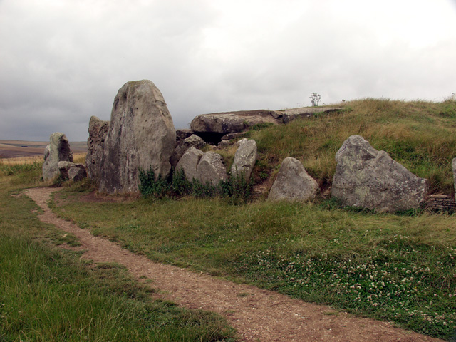
Of all the burial mounds, long barrows (below) are the oldest. There are around 300 of them in England and Scotland and a handful in Wales, all dating to the early Neolithic, contemporaries of the cromlechs and quoits of upland Britain. As the name suggests they are long – up to 125m – and they are usually the site of multiple interments. Their physical dominance of the landscape, and elaborate construction – some, like Belas Knap, Gloucestershire even have false entrances – inspired legends about their origin, the Wayland Smithy on the Berkshire Downs is a good example.
Reading the Landscape: Drove Roads
05 06, 13
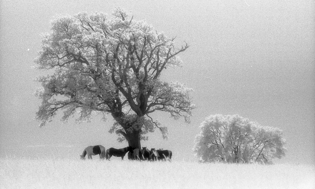
Among the oldest thoroughfares in Britain, drove roads were, for all practical purposes, the primary route network of their time. At their height between the Middle Ages and the Industrial Revolution, the roads linked the wild corners of Britain – particularly Scotland, Wales and the Westcountry – with the growing demands of towns and cities where livestock could be brought to market.
Extraordinary numbers of cattle and livestock were involved; in 1794, 10,000 cattle were exported from Anglesey alone, while 30,000 passed through Hereford each year. The routes from the north were just as busy; Scotland’s own extensive network of drove roads fed huge herds to fairs like the Falkirk Tryst, from where the cattle would begin an even longer journey south at the hands of their new owners. In 1663, 18,574 cattle were recorded on their way through Carlisle, while in Yorkshire during the early 19th century, up to 100,000 were herded each year towards Southern England on Hambleton Street, one of Britain’s most ancient trackways .
Cattle drovers steered clear of the settled population; for most of their length, routes ran over isolated ridgeways and kept away from villages, a strategy which had the added benefit of avoiding hefty turnpike fees and delays.
Many of the old tracks are known by their original names – Old Shaston and Ox Droves in Wiltshire, for example – while others take a little investigative work to discover. There are over a hundred hamlets and village streets called Little London in Britain – where Welsh drovers set up temporary communities on common land a short distance from an established village – and a nearby road or track called Welsh or Welshman’s Road, Cow, Bullock or Ox Lane, is likely to be the drover’s route itself.
Drove roads are broad for country lanes – anything between 40 and 50 feet across (12-15 m) is common, while a few are up to 90 feet (27 m) wide – with generous verges for grazing and dog-leg turns that provide shelter from the worse of the weather. The line of road is often marked by regularly spaced evergreens towering incongruously above the hedge-line, usually scots pine, laurel or holly, but sometimes yew, particularly in Hampshire. A clump of three or five evergreens together would mark a crossroads, a water-hole or an inn and where drovers stopped for the night, the cattle would graze – two-for-a-penny – in Halfpenny greens by the inns.
The railways brought centuries of droving to a rapid end and now, though the roads still run over the ridgeways of Britain, they are peaceful byways where the sweat and thunder of passing cattle is now supplanted by the whispering rustle of ramblers’ cagoules.
Reading the Landscape: Beside the Seaside
08 05, 13
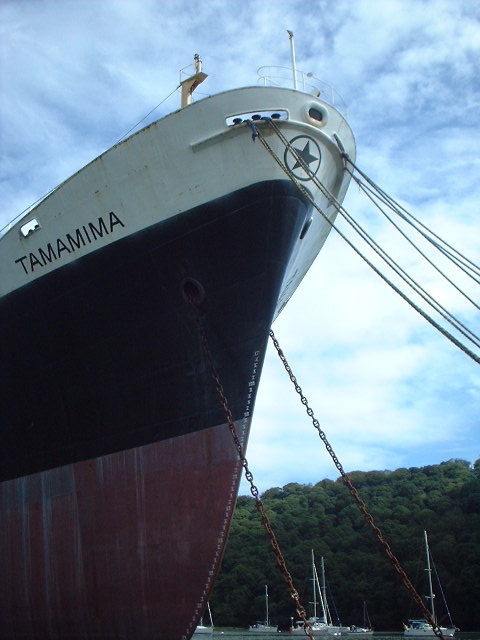
The Ukranian-crewed cargo ship, Tamamima, slowly rusting in the upper reaches of the Fal Estuary, close to the King Harry Ferry. More information on the Tamamima can be found here
While the rest of this special edition of the magazine takes to the canals and rivers of Britain, we couldn’t let the month pass without a look at the landforms that are found next to Britain’s most important waterway – one that you’re famously never more than 70 miles or so from in the UK – the sea. At nearly 20,000 miles long and formed from countless permutations of geology and topography, there’s a variety of features to see along the coastline of Britain.
Having said that, there are parts of Scotland that appear to have borrowed Nordic landforms – its north and west coast are punctuated by steep glacier-gouged fjords; each U-shaped valley terminating in sea lochs like Loch Broom by Ullapool or the glorious Loch Etive a few miles north of Oban. Although not as forbidding as their Norwegian counterparts, Scottish fjords share a heritage with the mountains of Scandinavia that goes beyond their glacial origins; they are part of the same mountain range – eroded to a fifth of its former height and torn apart by the same tectonic processes that opened up the Atlantic Ocean, while the rest of the range forms the Appalachians of the eastern USA.
At the other end of Britain, the drowned valleys or ‘rias’ of Cornwall and Devon are stunning examples of what happened when the glaciers melted. The rise in sea level – between 100-120 metres – inundated coastal valleys from Milford Haven in Wales around the coast to Southampton Water and the Solent. Among them, the Carrick Roads at Falmouth is the third deepest natural harbour in the world (after Sydney and Rio de Janeiro, since you ask), while five miles upstream and to all intents and purposes in the middle of the countryside, the channel is still deep enough to mothball container ships next to the chain-link King Harry Ferry. Despite the incongruity, like other rias – the Helford, the Fowey, the Tavy, Tamar and Dart, sylvan valleys with woods to the water’s edge and the odd bottomless boat slowly melting back into the river – the Fal maintains an air of tranquility.
Further east, Dorset’s Jurassic Coast displays a stunning set of landforms made by differential erosion; headlands of harder rock than the bays they frame, arches, sea-stacks and coves, but its most striking feature is Chesil Bank, an 18-mile long barrier beach that sweeps into the base of the Isle of Portland. It was originally described as Britain’s largest tombolo – a spit formed by refraction of currents around an island – but geomorphologists have changed their minds about that and say it only looks like one, transferring the honour further north among Shetland’s fjords – or voes – to the sandy tombolo that connects St Ninian’s Isle to the Mainland.
Reading the Landscape: Grim’s Dykes
01 03, 13
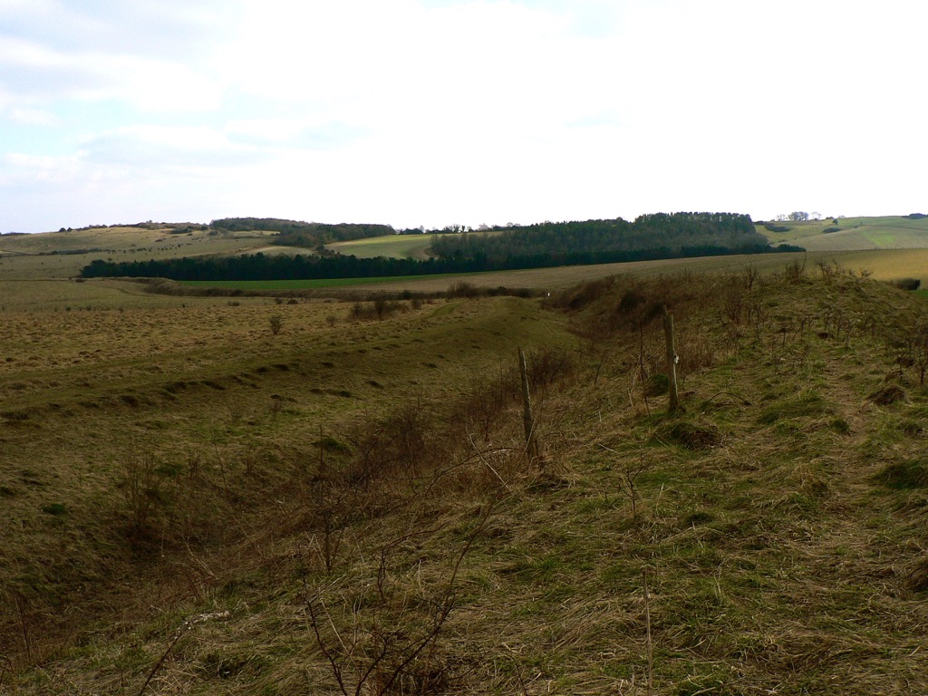
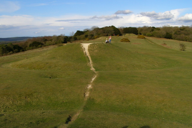
Bokerley Dyke snaking its way southeast. The Saxons would have tried to invade from the left
March may be the official start of spring, a little warmer and with promises to keep, but it also hides a dark secret, for the month has martial connections. Named after Mars, the Roman god of war, it was not only the start of the Roman year, but also the month for mounting military campaigns. Those campaigns, and many more before and since, have left obvious marks on the countryside; battlefields, motte and baileys and castle keeps we would all recognise the names of, from Hadrian’s Wall to the half-mile-long magnificence of Maiden Castle in Dorset, with medieval and Tudor strongholds the length of the country between. The ubiquity of battle and war in every corner of Britain is evidence of the part that conflict has played in our history, but for every famous hillfort, castle and Roman wall, there are dozens of military connections hiding quietly in our countryside.
Among them, the miles of Iron Age Grim’s Dykes or Ditches that are common in Wessex and are believed to be territorial markers. Though not of a sufficient scale for military use – where they can still be tracked on the ground they tend to be of the scale of a modest railway embankment – the ditches have an etymological cousin in Graham’s Dyke, a local name for the Roman’s short-lived Antonine Wall across the Central Lowlands of Scotland. Grim was the Old English name for the Anglo-Saxon god of war, Woden, and other Grim’s Ditches, particularly the one at Colton, east of Leeds, may have been substantial enough to have a defensive use.
Compared to Offa’s Dyke – up to 65 feet at its widest and at least 64 miles long – Grim’s Dykes may seem modest. The eponymous creation of the eighth-century King of Mercia, Offa’s Dyke marks the English-Welsh border (running along Marches of a different kind) and is a potent symbol of tension throughout history. The dyke is built to have commanding views of Powys to the west, with the bank on the Mercian side and the ditch in front to deter any hapless invaders from Wales.
Seven-hundred years before Offa, at Wales’ northwestern horn, advancing Roman legions were confounded by both the treacherous Menai Straits and the Celtic tribes of Ynys Môn (Anglesey) on the other side. Roman Governor Agricola inflicted a punishing and conclusive triumph over them in 78 AD, and Ynys Môn was taken for good, but the memory of his brutal campaign is allegedly preserved in the names of fields; close to Brynsiencyn on the island, one howls its name as Cae-oer-waedd or the ‘Field of Bitter Lamentation’, another is simply “The Field of the Long Battle”.
Reading the Landscape: Ridges and Bumps
01 02, 13
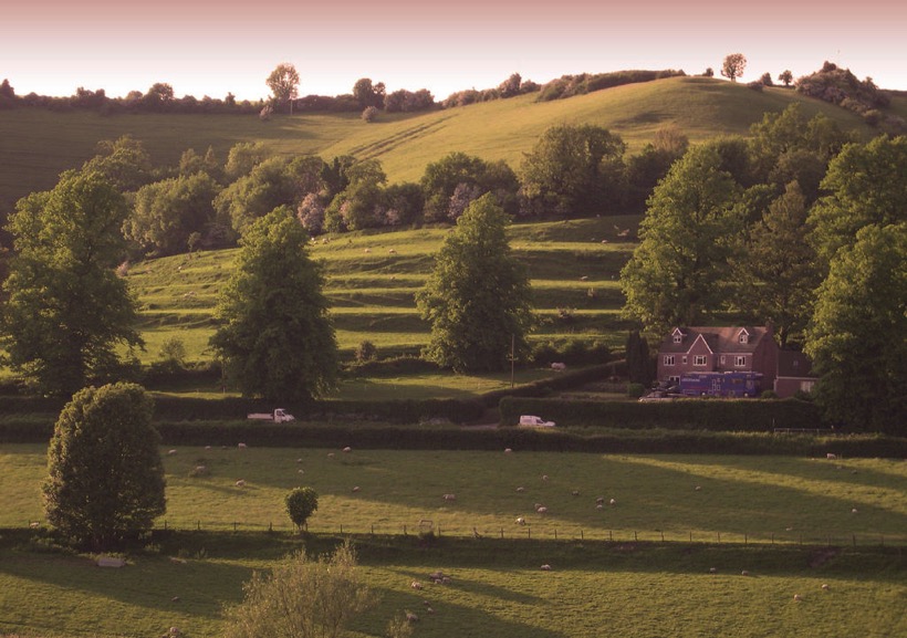
Strip Lynchets at Coombe Hill, Wooton-Under-Edge, Gloucestershire. Photo credit: Synwell / Foter.com / CC BY-NC-ND
As January passes into February, halfway from winter solstice to spring but still the coldest part of the year, it often feels as if it is a distinct season of its own. With low grass in the fields, a touch of frost or a light dusting of snow can reveal a swarm of slumbering lumps, bumps and hummocks of every form, suddenly apparent in a landscape sculpted by the long shadows of the low sun.
Despite appearances, many of these undulations, earthen ripples and waves across the landscape, are not defensive earthworks, ramparts or relics of long-forgotten battles, but evidence of our ancestors’ struggle with the land itself – the remains of various ancient methods of farming – while some are the outcome of nothing more violent than the gradual creep of soil down a hill, occasionally exacerbated by the frolicking trot of sheep.
The most marked features are those shown on Ordnance Survey maps as ‘Strip Lynchets’, the consequence of ploughing along the contours of slopes to create a flat area for crops, as practised in medieval and, occasionally, even earlier times. Dorset and Wiltshire have the best examples – below the Ridgeway near Bishopstone in North Wiltshire and near the village of Loders near Bridport, where giant stair-flights climb the slope; it’s not for nothing that ‘risers’ and ‘treads’ have crept into the terminology of strip lynchets to describe the relevant parts. Further north, at Conistone in Upper Wharfedale and Hall Garth, near Great Musgrave in Cumbria, the effect is gentler, but just as striking.
On more level ground, a pattern of regular undulation can reveal another medieval farming practice – ridge and furrow. Vast open fields were cultivated in furlong (literally furrow-long) strips by tenant subsistence farmers. Working clockwise around their strip, their ploughs turned the sod inward, building up a shallow ridge at the centre of their strip and leaving furrows along the long edges. Hauled by a team of eight oxen, the turning circle in the headland was difficult to achieve without curving slightly to the left at the end of each furlong and a shallow reverse-S or C form to the ridge can often be detected.
In the angular light cast on a February day, far subtler features can be discovered. Thin bands known as terracettes – but sometimes called catsteps or sheep tracks – are formed by soil creeping down steep slopes over the years, a result of repeated saturation and drying. Where bare sedimentary rock is exposed, a light fall of snow might pick out its bedding planes, revealing a succession of sea beds over millions of years or even, on red sandstones, the swash of a desert dune – a geological comfort for the middle of winter.
Reading the Landscape: Snow Business
01 01, 13
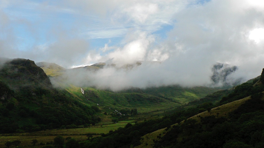
As the mid-winter celebratory twink and glitter passes by and the season threatens to throw its worst at us in the shape of a cold snap or two, it’s a good time to consider how our landscape has been shaped by ice and snow over our long history. Most of us will be familiar with the U-shaped valleys of the Lake District, Snowdonia and the Scottish Highlands, gouged out by glaciers during the last ice age and hammered into our consciousness by geography lessons since time immemorial, but they are not the only effect of glaciation which, like love, changes everything.
Every part of Britain has been affected in some way by the various glaciations of the last two million years. When glaciers tower to 800 metres, as they did during their most recent appearance between 10 and 20,000 years ago, it should come as no surprise that the features they shape are of a similarly colossal scale, but even a periglacial climate creates huge features in the landscape and their effect upon our countryside is all around us, no matter how far north or south we are.
At 100 metres deep, the Devil’s Dyke, just north of Brighton is the deepest dry valley in the world and its creation was a consequence of what tundra does to porous rock. Situated on chalk, a rock that usually has the porosity of a sponge but which became frozen and impermeable during the last ice age, the area would nevertheless have enjoyed the briefest of Arctic summers. Warm enough, perhaps, to thaw the chalk nearest the surface, which would be sludged away by the meltwater from the snowfields, leaving frozen, impermeable chalk to be eroded by a great meltwater river.
Further north, at the boundary between the ice and tundra, huge mounds called moraines were left at the snouts of glaciers and the most impressive of these forms the Cromer Ridge in North Norfolk, a nine-mile line of hills over 300 foot-high made from clay and boulders bulldozed up from the floor of the North Sea.
But what of the land that was ground down to be eventually deposited as irregular blobs on a landscape hundreds, if not thousands, of miles away? Aside from U-shaped valleys, the most famous outcomes of glacial progress are the whale-back hills known as drumlins. Rounded hills with ‘blunt’ ends that face the origin of the glacier and a long tapered tail on the lee side, drumlins often occur in swarms and form what is termed, rather descriptively, a ‘basket of eggs topography’. There’s an excellent set of them in Ribbleshead in Yorkshire, but since there are 8350 of them in Britain, it might be worth a trudge out in the snow to find your own.
Reading the Landscape: Park Pale
01 12, 12
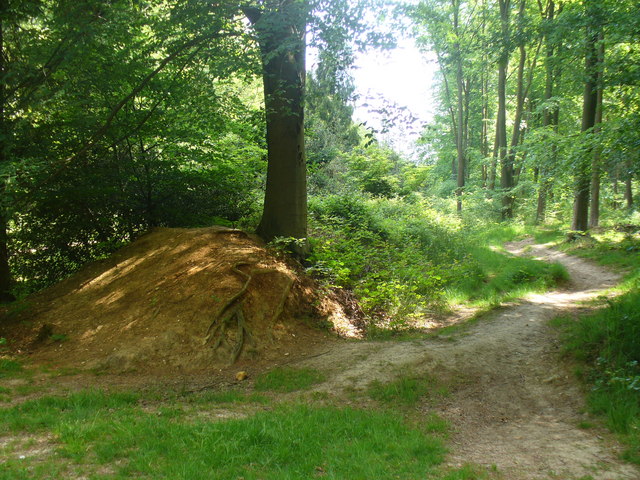
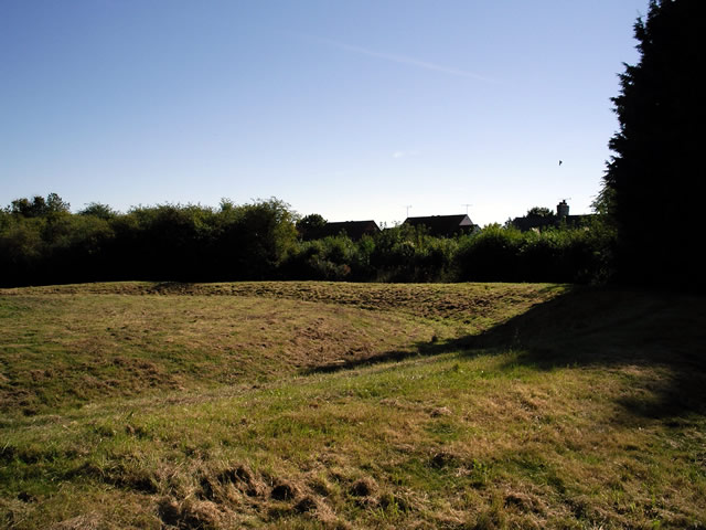
Low embankment, mostly covered in bushes, in Chawton Park Wood. The pale is probably an old royal park boundary and it could run alongside the alignment of a Roman road. Link © Copyright Colin Smith and licensed for reuse under this Creative Commons Licence • http://www.geograph.org.uk/photo/2420145
A familiar label, a ‘park pale’ – as rendered in Old English blackletter on Ordnance Survey maps – marks the ditch and bank that formed the boundary of a medieval deer park. On the ground they might still define an area of woodland pasture, while banks several metres wide, once surmounted by a palisade or, perhaps, still carrying a stone wall, can be substantial even after centuries. The ditch that runs on the inside of the bank is usually less distinct. Their design allowed deer to bound into the park, but prevented them from leaping out again, making the deer park like a huge, terrestrial lobster pot, harvesting meat for the aristocratic table.
It’s a fitting feature to investigate during the season of high octane food, not least because in the low-fat, calorie-counted, gastronomically-tightfisted twenty-first century, Christmas dinner is the closest most of us get to a proper medieval banquet – a seasonal version of which was likely to include venison, while the most kindly of lords might give their servants deer offal – or numbles – for baking into a numble pie.
The model on which the ornamental parks of the eighteenth century were based, the medieval deer park is a landscape tradition whose roots extend back to the Norman conquest. William the Conqueror, who was crowned as an English monarch on Christmas Day, 1066, famously created 36 Royal Forests in the twenty-one years of his reign, reflecting his enthusiasm for the chase. At first, keeping and hunting deer was exclusively the reserve of royalty, but licenses from the King gave members of the aristocracy and senior churchmen the right to hunt on their own lands and a mania for creating deer parks took hold. The remains of one such park – first recorded in 1291, but almost certainly older – can be seen on the eastern side of Lyndhurst in the New Forest, where the pale is 9 metres wide and its bank over a metre high. Another park pale is associated with Kenilworth Castle and Pleasance – Henry V’s manor house in Warwickshire – while the most outstanding example in Scotland is at Fettercairn in Aberdeenshire, where eight miles of pale around the King’s Deer Park may even pre-date the Norman conquest of England.
The frequent occurrence of the park pale on modern maps is a reflection of their ubiquity in medieval landscapes; deer parks covered as much as 2% of England at the start of the fourteenth century and had a political importance to match. While there was no shortage of deer parks, there were shortages of deer because noble huntsmen were rather good at killing their trapped quarry, quicker than they could be re-stocked by hapless deer bounding over the pale. With his large Royal Forests, the King could send deer to his more co-operative and influential lords.
Reading the Landscape: Lych Gate
01 11, 12
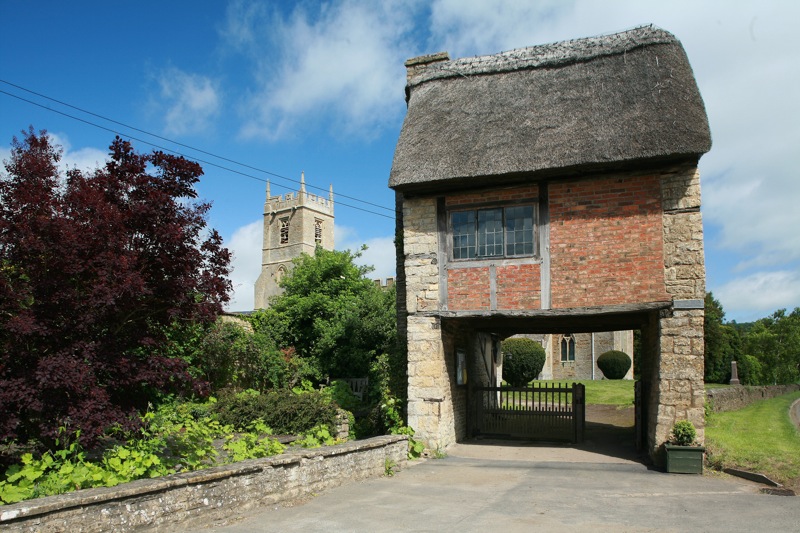
Lych Gate at Long Compton Church, Warwickshire. Photo credit: Hellsgeriatric / Foter.com / CC BY-NC-ND
In a month that starts with All Hallows and All Souls, two opening feast days of November that sift and grade the dearly departed for salvation – first the saints and then the aints – it’s natural to look at the earthly, temporal end of the process. After all, before anybody gets to pray for your soul, there’s the matter of getting into the churchyard in the first place.
Lych gates, which acquired their name from the Saxon word for corpse, stand at the threshold of all thresholds, the entrance to God’s acre. Although many were built before 1549 – Beckenham and Boughton Monchelsea in Kent are dated to the thirteenth and fifteenth centuries, respectively – it became a requirement of the Book of Common Prayer that priests “metyng the corpse at the church style” should commence the service there and that only encouraged construction of lych gates to keep everybody (and every body) dry.
As if hiding their true and gruesome purpose, lych-gates often have a charming gingerbread cottage-cum-chocolate box appeal. They are commonly built from stout timbers and capped by a pleasing and petite doll’s house roof, but the gate at Long Compton church in Warwickshire surpasses all of that to find itself at the peak of picturesque – an entire seventeenth century thatched cottage, minus most of its ground floor, the last surviving of an old row demolished in the 1920s, functions as the churchyard’s gate.
Other designs are grander, the gate at St Peter’s Church, Carmarthen is a vaulted Victorian gothic creation in red sandstone which competes for attention with the lime-rendered tower of Wales’ largest parish church. Sometimes, as at the church of St Germanus, Rame in southeast Cornwall, the gate appears to be a funereal dual carriageway complete with a six-foot long central reservation, the bier or lych stone, to park the deceased on, while benches on either side were provided for the pallbearers, who may have had to walk long distances to church.
Corpse ways to outlying areas of the parish were part of an extensive funereal topography, especially in upland Britain. In Derbyshire, before Coton-in-the-Elms had its own church, bodies were carried a mile and a half along Procession Way to Lullington for burial. The mourners passed under a curve of tree boughs known as the Devil’s Arches on their journey. In Devon, a long-distance footpath – the “Lich Way” – follows a twelve-mile long corpse road over the moor to the church at Lydford and, this being Dartmoor, there are tales of spectral monks walking the trail on moonlit nights.